![](/images/other/stat-length.png)
![Excursión A pie Le Claux - Les Chamois - Photo](https://media.geolcdn.com/t/1900/400/510ea3bc-7b5b-4a87-873e-65c3812ffcb2.jpeg&format=pjpeg&maxdim=2)
Les Chamois
SityTrail - itinéraires balisés pédestres
Tous les sentiers balisés d’Europe GUIDE+
![Longitud](/images/other/stat-length.png)
Longitud
17,3 km
![Altitud máxima](https://static1.geolcdn.com/siteimages/upload/files/1508320355ic_sort_altitude_max_24dp.png)
Altitud máxima
1414 m
![Desnivel positivo](https://static1.geolcdn.com/siteimages/upload/files/1508320355ic_sort_den_pos_24dp.png)
Desnivel positivo
537 m
![Km-Effort](/images/other/stat-length.png)
Km-Effort
25 km
![Altitud mínima](https://static1.geolcdn.com/siteimages/upload/files/1508320355ic_sort_altitude_min_24dp.png)
Altitud mínima
1035 m
![Desnivel negativo](https://static1.geolcdn.com/siteimages/upload/files/1508320355ic_sort_den_neg_24dp.png)
Desnivel negativo
594 m
![Boucle](https://static1.geolcdn.com/siteimages/upload/files/16400158638029165_repeat_loop_refresh_sync_direction_icon.png)
Boucle
No
Baliza
Fecha de creación :
2022-02-15 14:29:24.682
Última modificación :
2022-03-02 16:08:28.987
![A pie](https://static1.geolcdn.com/sitytour/trail-icons/100.png)
5h36
Dificultad : Medio
![Escanee este código QR para abrir la excursión en la aplicación SityTrail](https://capi.geolives.com/qq0zvz2zws4bq2lad0pu/sitytour/trails/3119935/qr.png?size=200)
Aplicación GPS de excursión GRATIS
A propósito
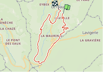
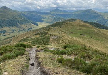
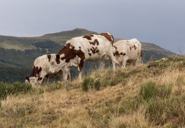
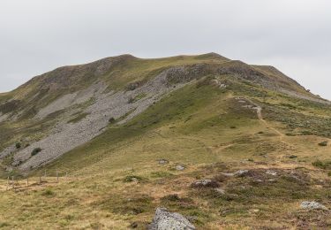
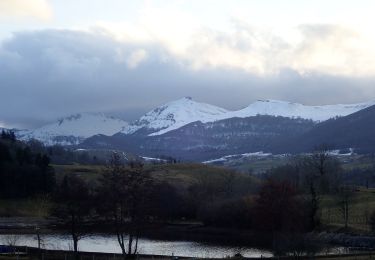
Ruta A pie de 17,3 km a descubrir en Auvergne-Rhône-Alpes, Cantal, Le Claux. Esta ruta ha sido propuesta por SityTrail - itinéraires balisés pédestres.
Descripción
Trail created by Grand Site du Puy Mary.
Symbol: Vert
Localización
País:
France
Región :
Auvergne-Rhône-Alpes
Departamento/provincia :
Cantal
Municipio :
Le Claux
Localidad:
Unknown
Salida:(Dec)
Salida:(UTM)
477365 ; 5000188 (31T) N.
Comentarios
Excursiones cerca
![Excursión Senderismo Lavigerie - Le Puy de Peyre Arse depuis la Gravière - Photo](https://media.geolcdn.com/t/375/260/ext.jpg?maxdim=2&url=https%3A%2F%2Fservices.sitytrail.com%2FGeolivesWS%2FDownloadMedia.ashx%3FTrailID%3D172317%26Media%3D13640_5.jpg)
![Senderismo Senderismo](https://static1.geolcdn.com/sitytour/trail-icons/101.png)
Le Puy de Peyre Arse depuis la Gravière
Senderismo
Difícil
(2)
Lavigerie,
Auvergne-Rhône-Alpes,
Cantal,
France
![](/images/other/stat-length.png)
11,2 km | 21 km-effort
4h 0min
![](https://static1.geolcdn.com/siteimages/upload/files/16400158638029165_repeat_loop_refresh_sync_direction_icon.png)
Sí
![Excursión A pie Lavigerie - La Vallée de l'Impradine - Photo](https://media.geolcdn.com/t/375/260/5cfb4f36-6b62-4698-bb5b-742b53da1677.jpeg&format=jpg&maxdim=2)
![A pie A pie](https://static1.geolcdn.com/sitytour/trail-icons/100.png)
La Vallée de l'Impradine
A pie
Fácil
Lavigerie,
Auvergne-Rhône-Alpes,
Cantal,
France
![](/images/other/stat-length.png)
5,5 km | 7,6 km-effort
1h 44min
![](https://static1.geolcdn.com/siteimages/upload/files/16400158638029165_repeat_loop_refresh_sync_direction_icon.png)
Sí
![Excursión A pie Le Falgoux - La Baladie - Photo](https://media.geolcdn.com/t/375/260/9844acfe-57cd-4ed2-9915-09bb258bc9c1.jpeg&format=jpg&maxdim=2)
![A pie A pie](https://static1.geolcdn.com/sitytour/trail-icons/100.png)
La Baladie
A pie
Fácil
(1)
Le Falgoux,
Auvergne-Rhône-Alpes,
Cantal,
France
![](/images/other/stat-length.png)
10,9 km | 18,5 km-effort
4h 11min
![](https://static1.geolcdn.com/siteimages/upload/files/16400158638029165_repeat_loop_refresh_sync_direction_icon.png)
Sí
![Excursión Senderismo Lavigerie - Cantal - La Gravière - Les Fours de Peyre-Arse - 18.9km 760m 8h05 (30mn) - 2019 07 04 - Photo](https://media.geolcdn.com/t/375/260/9cfe2185-2c98-490a-a2cb-4203d8093887.jpg&format=jpg&maxdim=2)
![Senderismo Senderismo](https://static1.geolcdn.com/sitytour/trail-icons/101.png)
Cantal - La Gravière - Les Fours de Peyre-Arse - 18.9km 760m 8h05 (30mn) - 20...
Senderismo
Difícil
Lavigerie,
Auvergne-Rhône-Alpes,
Cantal,
France
![](/images/other/stat-length.png)
18,9 km | 29 km-effort
8h 5min
![](https://static1.geolcdn.com/siteimages/upload/files/16400158638029165_repeat_loop_refresh_sync_direction_icon.png)
Sí
![Excursión Senderismo Lavigerie - Cantal - La Gravière - La Vallée de l'Impradine - 6km 170m 2h20 - 2019 07 03 - Photo](https://media.geolcdn.com/t/375/260/ed622756-45b3-433e-a699-9a4285d0a037.jpg&format=jpg&maxdim=2)
![Senderismo Senderismo](https://static1.geolcdn.com/sitytour/trail-icons/101.png)
Cantal - La Gravière - La Vallée de l'Impradine - 6km 170m 2h20 - 2019 07 03
Senderismo
Muy fácil
Lavigerie,
Auvergne-Rhône-Alpes,
Cantal,
France
![](/images/other/stat-length.png)
6 km | 8,3 km-effort
2h 20min
![](https://static1.geolcdn.com/siteimages/upload/files/16400158638029165_repeat_loop_refresh_sync_direction_icon.png)
Sí
![Excursión Senderismo Lavigerie - Puy de Niermont et plateau du Limon - Photo](https://media.geolcdn.com/t/375/260/45bc7963-cd83-41c1-9218-423d08db9901.jpg&format=jpg&maxdim=2)
![Senderismo Senderismo](https://static1.geolcdn.com/sitytour/trail-icons/101.png)
Puy de Niermont et plateau du Limon
Senderismo
Medio
Lavigerie,
Auvergne-Rhône-Alpes,
Cantal,
France
![](/images/other/stat-length.png)
18 km | 27 km-effort
6h 21min
![](https://static1.geolcdn.com/siteimages/upload/files/16400158638029165_repeat_loop_refresh_sync_direction_icon.png)
Sí
![Excursión A pie Le Claux - Sentier de Bois Mary - Photo](https://media.geolcdn.com/t/375/260/2a57266f-07e5-4ed2-91ba-75b3f67d0ce1.jpeg&format=jpg&maxdim=2)
![A pie A pie](https://static1.geolcdn.com/sitytour/trail-icons/100.png)
Sentier de Bois Mary
A pie
Fácil
Le Claux,
Auvergne-Rhône-Alpes,
Cantal,
France
![](/images/other/stat-length.png)
3,8 km | 5,3 km-effort
1h 12min
![](https://static1.geolcdn.com/siteimages/upload/files/16400158638029165_repeat_loop_refresh_sync_direction_icon.png)
No
![Excursión A pie Le Claux - Les Burons - Photo](https://media.geolcdn.com/t/375/260/1e82adfd-8408-4617-8b80-73dd51e5db33.jpeg&format=jpg&maxdim=2)
![A pie A pie](https://static1.geolcdn.com/sitytour/trail-icons/100.png)
Les Burons
A pie
Medio
Le Claux,
Auvergne-Rhône-Alpes,
Cantal,
France
![](/images/other/stat-length.png)
14,4 km | 22 km-effort
5h 0min
![](https://static1.geolcdn.com/siteimages/upload/files/16400158638029165_repeat_loop_refresh_sync_direction_icon.png)
Sí
![Excursión A pie Cheylade - Le Sentier des Cascades - Photo](https://media.geolcdn.com/t/375/260/50ff8ee6-a3cd-4395-9433-29a07f3bc278.jpeg&format=jpg&maxdim=2)
![A pie A pie](https://static1.geolcdn.com/sitytour/trail-icons/100.png)
Le Sentier des Cascades
A pie
Fácil
Cheylade,
Auvergne-Rhône-Alpes,
Cantal,
France
![](/images/other/stat-length.png)
4,2 km | 6,8 km-effort
1h 33min
![](https://static1.geolcdn.com/siteimages/upload/files/16400158638029165_repeat_loop_refresh_sync_direction_icon.png)
Sí